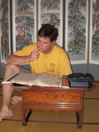
Larry and I went to Manly today on the ferry.
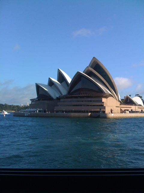
Larry and I went to Manly today on the ferry.
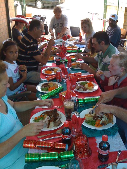
Today, we celebrated Christmas in La Perouse, on the southern coast of Sydney, among friends.
Thanks to Auntie Lois and the entire Lonell clan for such a wonderful meal and company. We were treated as nothing short of family.
Here is a snapshot from our Christmas dinner. What a feed!
Most of the Earth is water. And most of that water is in the Pacific Ocean, by far the world’s largest. Only the Pacific truly deserves the description of “vast,” where land is not even an exception worth mentioning. It’s a bucket of deep blue with specks of dirt in it.
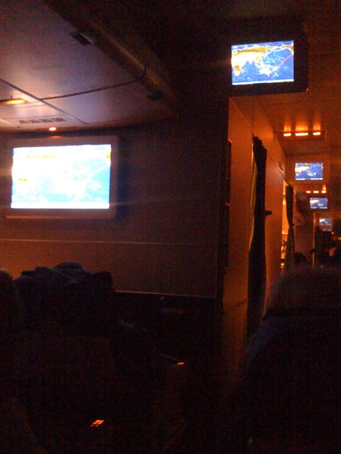
Crossing such an enormous expanse, from corner to corner, is a strange experience. Most likely, we live in at the end of an era, one that only began only a few hundred years ago. To us, crossing the Pacific is possible, whether by ship or plane, but both methods seem very long, relatively speaking, for that method of transport. It just seems to go on and on, and the comforts afforded to the (economy) traveler don’t seem like enough, even though today’s crossing is even more than yesterday’s science fiction. The looming era of ramjet engines and suborbital travel promise to shorten the trip time to where a nap may not even be possible and time zones zip by like invisible mile markers.
So, while not really comfortable at 37,340 feet and moving at 578 miles per hour, crammed into a seat sized for someone to sit upright for a two-hour trip, right now, I’m just glad not to be bobbing up and down in the waves, at the mercy of the wind, straining my eyes at the horizon, searching for a speck of brown among the blue.
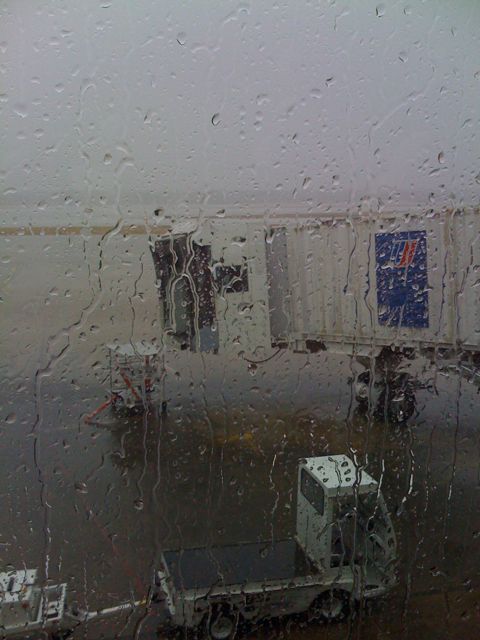
Well, I’m currently sitting in the Memphis Airport, waiting for the weather to clear enough for my 24-hour journey to Australia to begin.
This is my 5th trip to Australia since 1996, and while I always dread being locked in an aluminum tube for so long, I remain amazed by the ability we have to cross hemispheres and oceans so effortlessly. I can’t help but think that the first folks to arrive in Australia by boat from England would gladly trade places with me. I mean, I’m probably not going to get scurvy on my trip.
Kath and her father, Larry, are already in Sydney and waiting for me to arrive Christmas Day. We are planning to spend the day in La Perouse, visiting from house to house, the traditional Aboriginal celebration of the holiday. I’m eager to see them all, and I’m also looking forward to my first VB in 3 years.
So, while my fellow passengers are gnashing their teeth and complaining to anyone in a uniform over an additional wait of a couple of hours, I’m calm, tranquil, and ready.
Let the magical trip half-way around the world begin!
 I’ve been fascinated with Gibraltar for some time, and when the opportunity to visit popped up after our return to Spain via the ferry, we stashed our bags at a hostel near the ferry terminal and took a bus to La LÃnea de la Concepción and walked across the border to the British overseas territory. It was as fascinating as I had hoped.
Originally, we wanted to stay in Gibraltar, but we couldn’t find a hotel with any vacancies that we could afford, so we had to settle for a few short hours and a sunset meal. While we spoke the language, Gibraltar felt as different and interesting as Spain or Morocco had been – maybe even a little more.
For example, the runway in Gibraltar runs perpendicular to the main road (Winston Churchill Ave.) that enters the town from mainland Spain. There is literally a stoplight stops you from attempting to move across the runway when a jet is taking off or landing. Every bit of flat land in Gibraltar is used in some way.

On our way from Marrakesh to Fez on the train, everything rolled to a quick stop in the middle of nowhere. Outside our window was this sheepherder with his flock, and while you can’t tell from this photo, he was freaking out.
After some discussion in our cabin, we figured out that the train hit one of sheep while he was trying to cross the railroad tracks and the road. Apparently, livestock herders can demand immediate compensation from the railroad when things like this happen, and this guy really let loose and made sure that everyone know how upset he felt. Several folks from his small village came to join him and help with the “negotiations.”

On our way from Segovia to Becerril del Carpio to meet up with Christina’s parent, John and Harriet Ross, we stopped at a small town called Baños de Cerrato, located a few kilometers south of Palencia. Some of the sights mentioned in the Lonely Planet sounded interesting, particularly the chance to see the oldest church still standing in Spain, which was built by Visigoths way back in 661.
On our way out of town, I snapped a picture of this massive stork’s nest built above the bell tower of the town’s current church. These stork nests are all over Spain and Morocco, and they are considered good luck for the town where they are built, meaning they are very desired and protected. Interestingly, the storks in both countries don’t really play religious favorites as for where they build their nests. We saw them on church towers and mosque minerets alike. As long as it was the on the tallest structure around, the storks didn’t care.
I’m still not sure how they keep from being blown off, but I’ll leave that question to someone else and just enjoy the majesty of the balance of the entire structure.
In May 2008, Kath and I went on a wonderful trip to Spain and Morocco with Dave and Christina, and we had a wonderful time experiencing life in the small towns in northern Spain and contrasting that with the modern hustle-and-bustle of large Spanish and Moroccan towns.
Since we got back, I’ve been too busy to sit down and write about the experience, and I’m still too busy today. I’m hoping, thought, to start posting images from that trip, with a quick description of what we were doing, as a way to get down my thoughts before I forget many of the experiences. Undoubtedly, this will get very non-linear, so please excuse the jumping around.

The first photo was taking from a bridge (the Puente Principes de España) looking down on the Guggenheim. Kath and I had just toured the museum and were out getting a breath of fresh air. From here, you can see the side of the Guggenheim that faces the Nervion River, including the spider sculpture, called Maman (1999), and the walkway along the water, which gives you the sense of floating above the water. A storm was moving in, but we were able to make it across the bridge and back along the other side before it started drizzling.
As you can see, the Guggenheim building is simply stunning, covered in thin, shaped sheets of titanium. The way it reflects the sky and the colors around it gives you the sense of water, frozen but not ice, carved into wave-like shapes, at the same time functional and true to its surroundings.
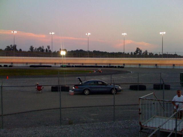
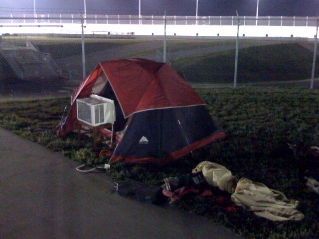
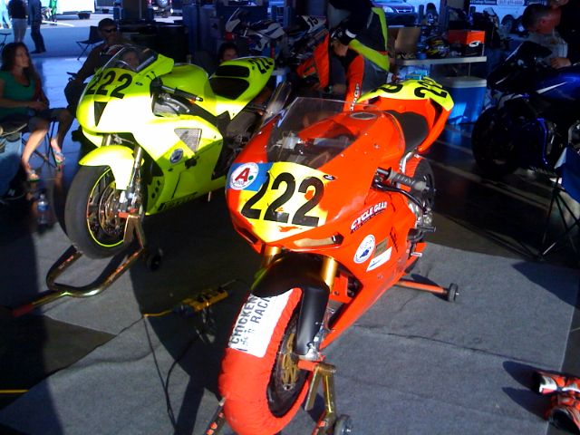
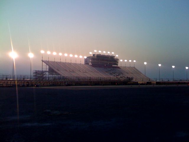
Thanks to Gigi and Michael for a great time at the Nashville Superspeedway on Saturday evening.
The track and the amatuer superbike scene is something to be experienced to be believed. It was my first time to visit a NASCAR-sized track. Huge. Really makes you feel small. And Michael was making the circuit in about a minute, hitting more than 150 mph in the straightaway.
I’ve been posting a few videos on YouTube from our time in Australia in 2001 and 2002, and I thought I would share a few of them here. This movie features the La Perouse Panthers in an exciting city championship game against Moore Park, one of their biggest rivals.
I still haven’t mastered getting the best quality video up on YouTube. I’ve tried several different methods to improve the resulting video after YouTube encodes my video after upload, but nothing has worked.
If anyone has a killer method of how to move a finished iMovie 2006 video to YouTube, please leave a comment. Thanks.
Jeff and Katy recently returned from a trip to China, which must have been an amazing journey, if their photos and descriptions are any indication. Some of my favorite posts cover Xian and the Terracotta Army and Shanghai, but there are several others listed on Jeff’s website, Peebo.net.
While Jeff was in China, I took care of some very easy website updating for him, and to say thanks, he got me a Chinese stamp with my name on it. This is similar to a stamp I gave to Dave in 1995, and I’ve been wishing I had picked one up for myself ever since coming back from China that year.
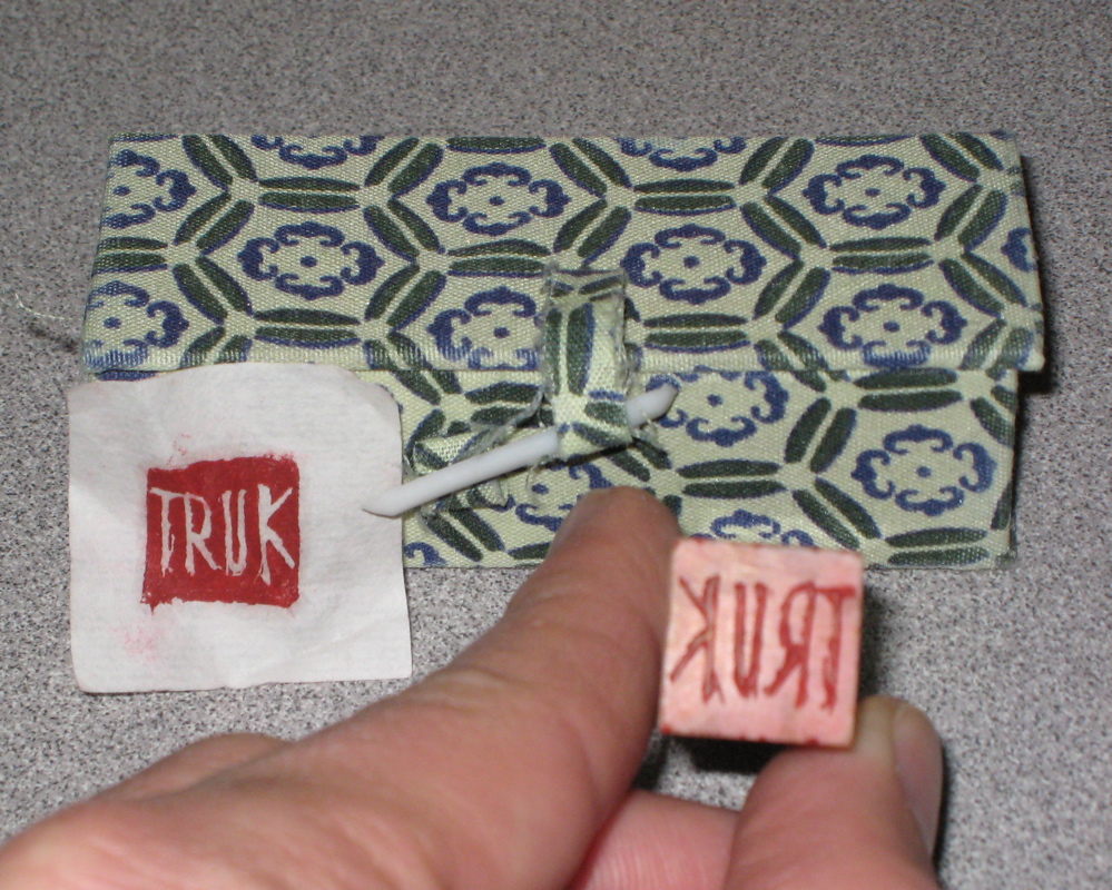
You can get these stamps made for you all over China, particularly anywhere there are tourists. They will carve whatever you want into stone (usually marble), though most people elect to simply get their name written in Chinese. I always wonder how many folks have a stamp that actually says something totally different than what they expect, simply because no one around them reads Chinese.
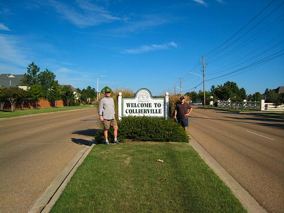
Last Saturday, I walked across Memphis with several friends, starting at the historic Mississippi River cobblestone landing at dawn and ending in Collierville, only a few miles from the Fayette County border. We covered just over 19 miles in less than 9 hours.
Richie, Robert, and I made it all of the way to Houston Levee Road at Wolf River Boulevard by 3:45 PM before needing to be picked up to make another appointment. Tom started with us but had to leave earlier than that for a previous engagement.
The purpose of the trip was to do a bit of urban exploring and see how far you could get by simply walking through the city in a single day. The original idea, which came from Frank (though he had a schedule conflict and couldn’t attend the walk), was to start at sunrise and stop walking at sunset. Simple enough, but Memphis offers several major routes running east-west, and part of the fun of the walk was figuring out, on the fly, how to see the most unusual sights in the most common locations while making the most progress eastward.
Downtown passed quickly. We started on Madison, switched to Union after visiting Quetzal for some coffee, and then rambled back to Madison before sliding over to Union again as we headed through Midtown. Poplar Avenue proved to be the best route through East Memphis, but in Germantown, we opted for a more directly easterly route, heading down Farmington Boulevard and Wolf River Boulevard before stopping after entering Collierville.
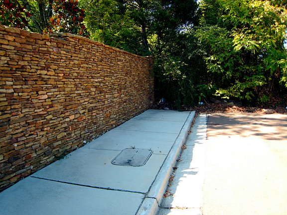
All along the way, we encountered interesting sights in places we had all driven through hundreds, if not thousands, of times before. Some highlights: the metallic art chair on Marshall, random apartment complex art in Midtown on Union, boats in the Midtown impound lot, giant drainage ditches in view of Clark Tower in East Memphis, railroad tracks over I-240, random sidewalk placement in Germantown, and a high school with an ornamental front entrance that isn’t accessible from the road.
All along the way, we were amazed by the amount of “car crumbs” (Richie’s description for the endless stream of broken bits of automobile plastic and metal that litters the sides of our roads and sidewalks) and lack of pedestrians (in spite of a perfect weather day for being outside – low humidity, with a high about 80). For example, we didn’t see any other pedestrians between Midtown to Farmington Boulevard, a distance of over 11 miles.
I would highly recommend this trip to anyone else that just wants to get out and see the city. Several folks mentioned that this might be a dangerous trip, but I found it to be trouble-free. Just get some comfortable shoes and a ride to drop you off downtown, and start walking east. You can buy everything you need along the way, and there are surprisingly few barriers or big intersections to trouble you.
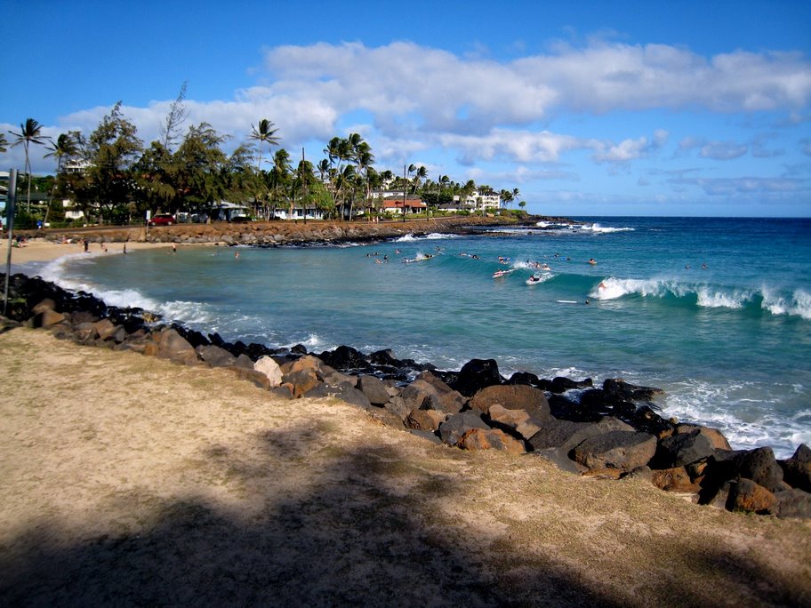
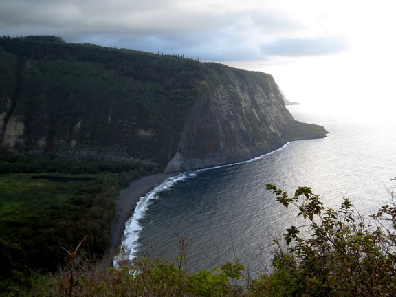
 It was hard to leave Mindy’s and the wonderful southwest side of Kauai, but we had a reservation in Wainiha on the north side that we had to keep. Especially given the cost of where we were staying, which we had to pay in advance to even keep our reservation! Because Kauai does not have a road that goes all the way around (which actually is a good thing – it keeps development in the fragile northwest portion of the island to a minimum), we had to circle the island, passing through the traffic messes that are Lihu’e and Kapa’a.
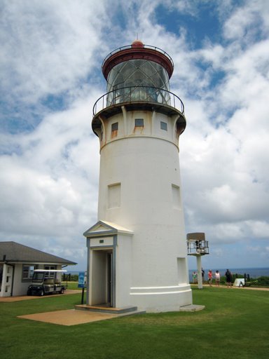
We stopped in Kilauea to check out the lighthouse and accompanying Kilauea Point National Wildlife Refuge, which was an unexpected treat. This place is a haven for birds (and bird lovers), where you can see the Pacific golden plover, Laysan Albatross, and the Nene (the official Hawai’ian state bird), all in one place, with a wonderful old, white lighthouse set before the pounding Pacific. The US government built the lighthouse in 1912, and it remained in operation through 1974, when a more modern, automated lighting system took over.
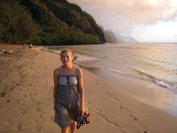
When we arrived in Wainiha, we finally got an idea of just far we had come from the bustle of the east side of Kauai. Past Hanalei, the pace really slows down, with an increase in the number of one-lane bridges and a road than runs for long stretches in a winding trail just above the ocean. Our rental place looked out over Kepuhi Beach, which was good for more than just the view and the nice breezes. It turns out that we were backed into a kind of chasm which kept out almost all radio waves, including cell phones and wifi. Even the FM and AM didn’t work. To get email during the 5 days we were there, we headed across the road to the beach, where the iPhone could barely get a signal, probably from Princeville, across Hanalei Bay. We actually loved the remoteness, and the lack of instant Internet access helped us get away from it all, even more.
We spent most of our time on the north side relaxing on beaches and snorkeling or swimming in the waters just off of them. This area of Kauai is a beach-goer’s paradise. From Queen’s Bath to Hideaways to Wai’oli on Hanalei Bay to Kepuhi, Tunnels, Ha’ena, and Ke’e beaches toward the end of highway 560, you could spend a month lounging on north shore beaches and not be bored with scenery. I’ll talk more about the beaches in a future posting, but all of them, without exception, were incredible. It rained a bit during different times of the day, but the sun was always shining in a half-hour or so, and we never had to leave the beach due to the weather.
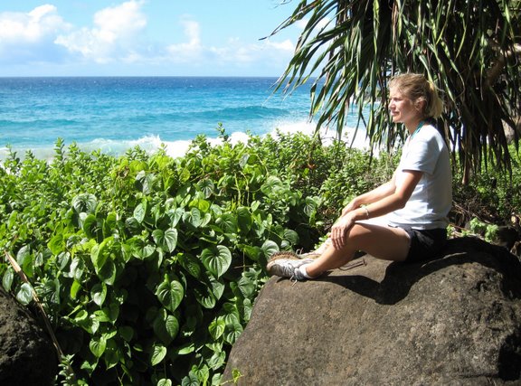
We took a great hike along the Kalalau Trail, which starts at the end of the road, at Ke’e Beach. While only 11 miles long, this is some of the most challenging, literally breathtaking, and visually stunning hiking in the world. While we only went a couple of miles in, to Hanakapi’ai Beach (the furthest you can go without a camping permit), the hike really stoked our sense of adventure. We really felt like we were seeing one of the wild places of the world, much like our hike in December 2005 through Abel Tasman in New Zealand. The ocean crashes into the beach with tremendous force, as the coastline come right out of the water and the beach is only there because of a river that runs through the chasm. We found a sea cave just to the west of the beach, filled with nesting sea birds. While we were exhausted when we got back, the hike left me wanting to see more of the coastline.
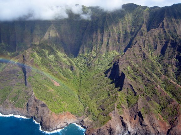
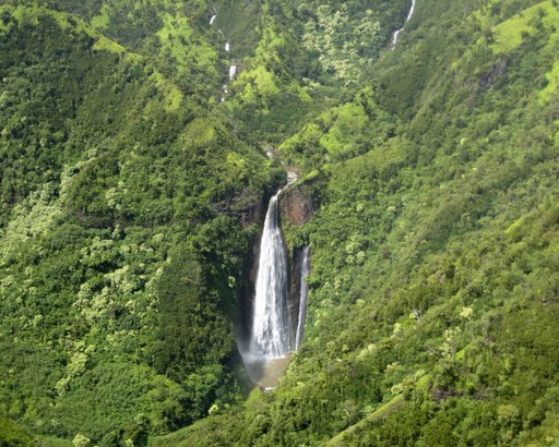
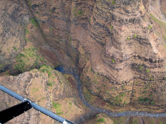
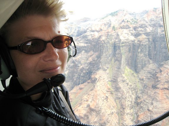
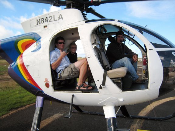
 To this end, we took a helicopter tour of the entire island just before catching our series of flights home. This allowed us to float above the Na Pali rugged coastline and see many places that it is impossible to get to by hiking or taking a boat.
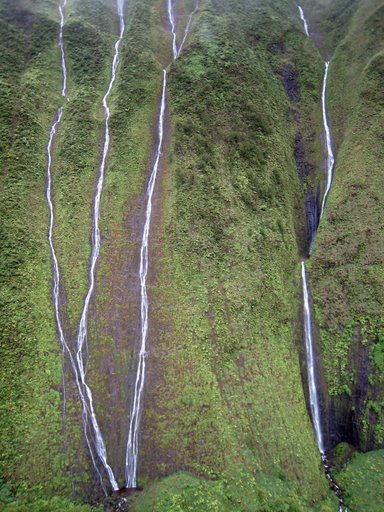
While it cost a lot, the helicopter trip was definitely worth it. Circling the Wai’ale’ale Crater, surrounded by a dozen waterfalls streaming down a thousand feet, well, that was simply incredible. It’s another place that is impossible to describe with words or pictures.
Traditionally, the area was kapu (taboo) and people were forbidden to enter. Even floating around inside the crater in a helicopter with the doors off, I could get a sense of the magic, and I was filled with wonder.
Kath and I are back in Memphis now, after what seems like one of the best trips we’ve ever taken. Coming back to Memphis was actually a little depressing. I love Memphis, don’t get me wrong, but when you’ve been used to staring at incredible beauty day after day, for more than two weeks, the endless strip malls and crumbling streets can really weigh you down.
It is probably best to break up a description of Kauai into one part covering the west and south sides of the island and another part featuring the northern coastline, as we stayed in both areas. This part will focus on the Waimea area in the southwest region of Kauai, were we were based for 4 days.
We stayed at a guesthouse loft in Kekaha called Mindy’s, which turned out to the best value place for the entire trip. Mindy and Dave were great hosts, and they really went out of their way to make us feel welcome. We could walk a few to the Kekaha Beach Park and watch the paddle surfers or take a refreshing swim anytime we felt the urge.
However, there was a lot to see all over Kauai, especially on the western side, so we spent a lot of time roaming around and taking it in. We drove (in our rental car – a yellow, PT Cruiser – ugh, terrible choice made by Dollar) to the end of Highway 50 on the west side, behind the back of the Pacific Missile Range Facility and close enough to Polihale State Park to know where the best sunsets could be seen.
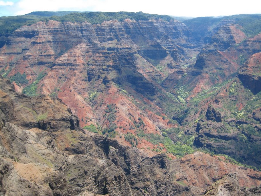
The next day, we checked out the Waimea Canyon and Koke’e State Park areas. The views on all of the roads around the canyon, particular the Waimea Canyon Drive are just stunning. Save an entire day for this activity, if you want to get out and do some short hikes, stop at most of the scenic overlooks, and drive down one of the ridge roads. While the views are breathtaking, perhaps the magical part involved the ever-changing weather and flora that you encounter just off the main roads.
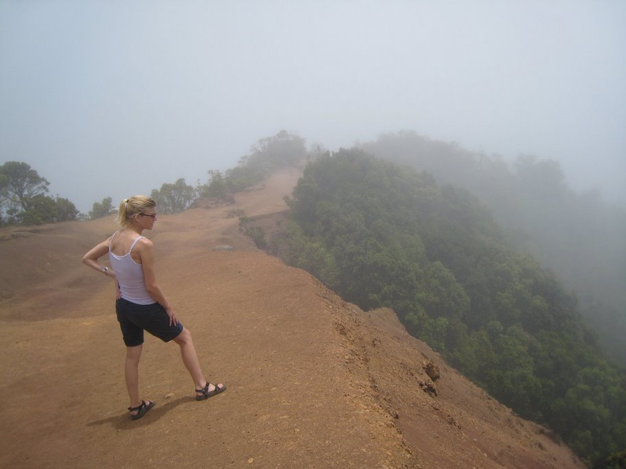
We walked about a mile past the Pu’u o Kila lookout and watched the clouds blow over the ridge, stream through us, and back down the other side, down into the Kalalau Valley, a place we would see from the air a week later.

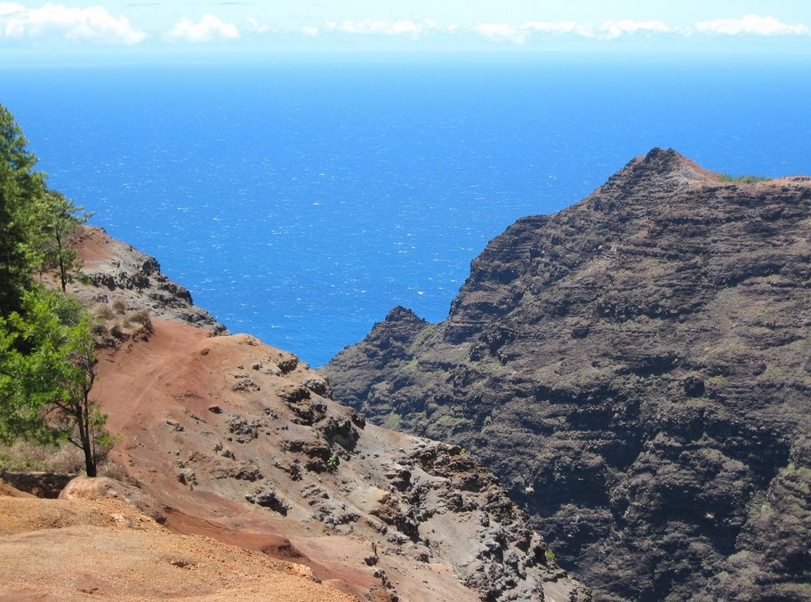
While most folks hit a few of the overlooks and head back for the beach, we lingered along the Makaha Ridge Road, stopping just before the Makaha Ridge Tracking Station to snap some pics. This area is completely remote and empty, except for swooping birds and the crushing sounds of the ocean 1000 feet below. I only wish we had thought to bring a picnic…
We spent another relaxing day in Po’ipu, which is largely a resort and residential area. Normally, this would not have been my first choice, but as we came to discover on Hawaii, while no one owns the beach, most of the best beaches are surrounded by development, and there is no way to totally avoid it, if you want a sandy beach experience reachable without a long hike. The Po’ipu Beach Park and Brennecke Beach consistently win awards as some of the best beaches in the world, and it wasn’t hard to see why. There is some decent snorkeling from the beach at Po’ipu, and I made it over to a sandy island and almost stepped on a monk seal. Apparently, I’m not the first person to encounter the wildlife here… In the breakers, just beyond the protective sea wall, you can view sea turtles coming up for air as they ride the waves only feet away from bodyboarders. While the Grand Hyatt Kauai and many vacation homes keep this area full of vacationers year-round, we never felt crammed in by people. There is plenty of space and lots to do all around Po’ipu.
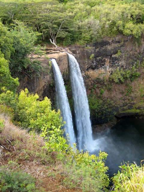 On our way around to the north side of the island, we stopped at Wailua Falls. This sight, while beautiful, wasn’t really worth the drive out of Lihu’e. In a way, it broke the spell that Kauai put on us (and which we badly needed). There is just so much to do on the island that you feel a little overwhelmed. There is beauty everywhere you look. I mean, munching on a $1.50 hot dog in the Costco parking lot, you are staring up at the amazing Ha’upu Range. You can’t get away from it. Wailua Falls brought us back down to earth, and we were finally able to enjoy the majesty of the island without the pressure to see every sight and enjoy every activity, because we knew that not everything would live up to our expectations. But almost everything else on the island did…
We haven’t been able to post anything for the past few days, as we are on the very edge of cell signal (and civilization) at our current place, but that has afforded us more time to enjoy the paradise that is Kauai.
We have been hanging out at a different beautiful beach every day, catching rays and snorkeling, gazing at fascinating fish and turtles, and avoiding traffic jams and other people as much as possible. We even hiked a part of the incredible Na Pali coast to a wild beach and discovered a hidden cave along the coast.
It is hard to believe we have to leave tomorrow. Usually, I’m quite ready by this point to return to civilization. But, here, in this still wild end of Hawaii, I don’t believe I’ve seen a tenth of its magic. I now know why people come back year after year…
Posted by iPhone from Kepuhi Beach
“Are you Japanese, sir?”
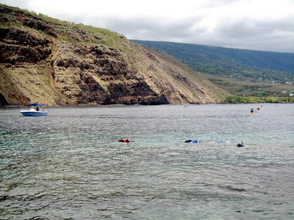
These are some of the first words I heard, as we prepared to cross Kealakekua Bay in our rented ocean kayak, hoping to approach the dying place of (Captain) James Cook and, perhaps, the finest snorkeling on Hawaii.
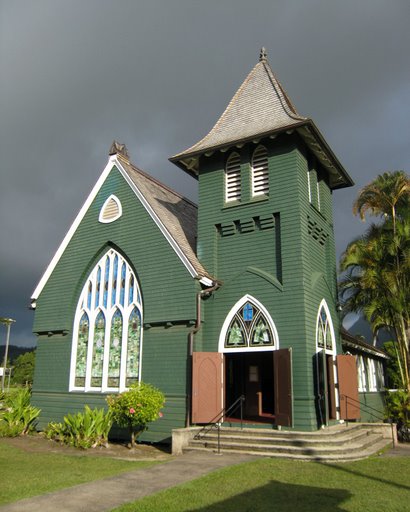
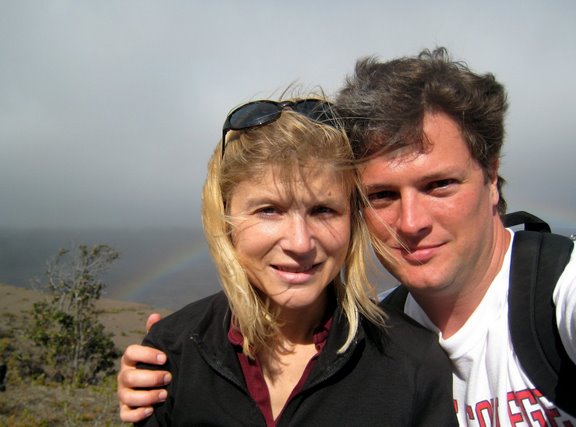
Where to start? Kath is a a cultural anthropologist, studying urban Aborigines in Australia, and her particular emphasis is on the Kooris in La Perouse, in the northern mouth of Botany Bay, Sydney. This is the same place that Cook first landed in Australia. In fact, if you look across the bay from where she spend endless afternoons, gathering stories from the locals and trying to gain the understandings of the folks clustered around Yarra Bay House, you will see the place where Captain Cook first landed on Terra Australis, though he didn’t really realize what it was. There are stories within the local Aboriginal inhabitants, some of which cover Cook’s initial landing and the reception that resulted, including Aborigines lobbing stones at the English, trying fruitlessly to drive them back into the sea. During the year that we spend in Australia among various Aboriginal groups, I heard over and over again that La Perouse is where “the bastards let Cook ashore.” As if Cook was the worst of their problems, then and now.
But what were we gubbas to think upon getting so close to the exact placement of Cook’s death?
After leading 3 largely successful expeditions of the Pacific for the the Crown, Cook was killed, quite ungracefully, on the volcanic beach at Kealakekua Bay on the Big Island of Hawaii, across from the current harbor, where his body was, well, cut up and preserved by the victorious Hawaiians, in the method that they would afford a great leader, before portions of it were returned to the HMS Resolution for a proper burial at sea, only after a demand by the crew. (There is too much to this fascinating story to relate here; for details, check out Wikipedia’s take on this event.)
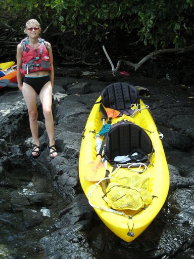 For our part, we rented an ocean kayak and some snorkeling equipment the night before from Pineapple Park (our kindly hotel up the road from the Bay), and we arrived early, hoping to spend some time with the spinner dolphins of the Bay. We watched them for about an hour and then started progressing toward the monument site. Half-way across, we seemed to cross through the dolphin nursery, where the baby spinners were being guarded by one adult while the remainders fed, under the annoying, watchful eye of swimming tourists making marine mammal songs on their own (seriously). It was very cool, the little baby dolphins following us, curious, but too afraid to breach or even show much more than a fin.
But, before we could even get the kayak into the water, we had to navigate the locals, which are way more active on a beach than I would be at 7 in the morning. One woman stopped to help us get the kayak into the water, and then helped us get our seats connected right, after my intuitive just-go-by-feel was obviously a failure. I had the seats upside down, which is apparently a common thing that Japanese do all over Hawaii (getting things situated upside down, apparently), thereby earning me the infamous question. But, despite the embarrassment, we got underway and got what we were promised: some of the best snorkeling I could imagine, especially right off a tall landmass and island.
Kath and I stayed, tucked away on a little volcanic spit, until the mid-afternoon. By this time, I was fully ripened by my repeated trips into the water with snorkel and fins attached, and my back was stinging through the dried salt around my sunburn. We powered our way back to the dock and out of the water. The lady that wondered if I was Japanese was still there, directing traffic and wandering around to help newcomers. She really did personify Aloha.
The next day (July 10th), we spent wandering around the northeast portion of Hawaii, including some stunning beaches (such as Beach 69), before heading over the Saddle Road back to Hilo, where a plane was due to take us to Kuaui. We ended the day walking through Coconut Island with Kath, reflecting on our time in Hilo and wondering why it had to end.
From our first impressions of Kauai, it is a complete paradise. The sunsets are stunning, the pole surfers are mesmerizing , and red clay captivating. More later, as we figure more out about this place.
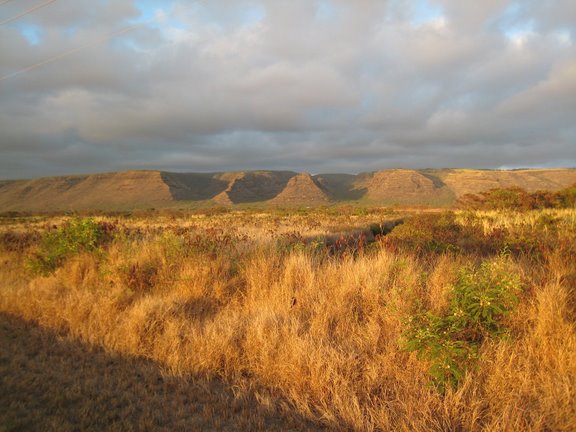
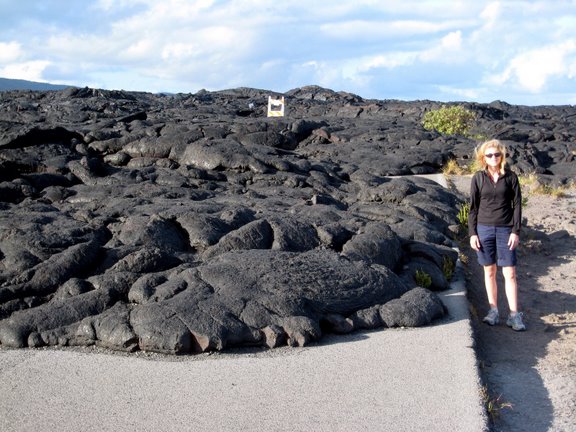
We spent most of the past few days exploring the Hawai’i Volcanos National Park. This (very) gradually expanding park features a lot to see and do, if by see, you mean look at expanses of black hardened lava, dormant calderas, and a few steam vents, and if by do, you mean hike around and baiting dehydration. We did a little of both, and it was really worth it.
We happened to come at a time when no lava is actively flowing down into the sea. On June 17th, after several years of pretty steady activity, part of the active Pu’u ‘O’o eruption area collapsed into itself, effectively sealing the lava flow off and causing the lava to only build up in one inaccessible area rather than sliding down the hillside to a place where we could get to it. Eventually, the lava will build up and overflow, probably creating a new path down to the ocean, but for now, there was nothing really to see other than the historical wrath of Pele. Thankfully, there was a lot of that to take in.
For the driving public, the park basically consists of 2 roads, one that leads around the crater and another that leads down from the crater to the sea. We took both, making sure to stop and take in the stark beauty as often as possible. While it would have been great to have gotten close to some active lava flows – particularly to cook some lava chicken – we actually got a chance to spend more time just taking in the landscape, which is amazing in its own right.
Before making it into the park, we explored the east side of the Big Island, in an area called Puna. This is a place of small, winding, one-lane roads that lead through stretches of lava fields and mangrove swamps, by seemingly suicidal surfers and ancient trees cooked by lava flows, whose crust now stands nearly immortal.
When we picked up the rental car, the Hawaiian lady behind the counter asked me where we were going, and when I mentioned that Puna was one of our destinations, she said, “Why? There’s nothing there. I live there; I should know.” A clever trick to keep a haole from discovering a slice of paradise or ignorance about one’s home? Who knows; all I can say is that, if you get the chance to go, definitely do it. There is something about walking across an expanse of 40-year old lava to the edge of the pounding ocean, far away from park rangers, common sense, and, well, probably legality.
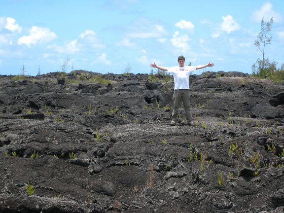
Inside the park, we walked to the end of the road, literally, where a 2003 lava flow covered up the highway through the park. It is a strange thing to see asphalt covered by a more organic but harder surface. The National Park Service really tries to strike a balance between allowing people to really get up close to really pretty dangerous areas without letting them go all out and hurt themselves. By looking at the flow’s expanse over the highway, a thing we can all visualize and understand, you can really get a sense of just how much liquid rock moved through that area. It is unlikely that highway will ever be cleared and rebuilt to connect with Puna.
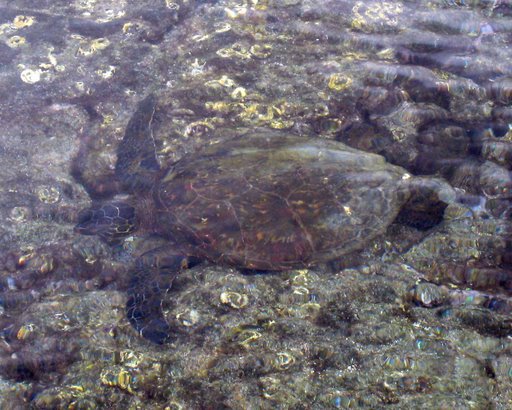
Today, walked through a 500 year-old lava tube, traipsed through a micro-rainforest on the side of the Mauna Loa (the largest volcano on Earth), watched a tiny lizard eat jelly out of a disposable packet, peered across the bay where Captain Cook was killed, drank way too much Kona coffee, and walked around a Hawaiian traditional kapu site, watching gigantic turtles looking back at us in crystal clear tidal pools. The day ended eating fresh wild-caught tuna steaks that I cooked behind our hostel, along with an organic salad and fresh edamame, while watching the sun gradually sink into the Pacific.
 The morning of July 5th was spent rushing around, complete with an expedition and exploration of downtown Wahiawa, in the center of Oahu. The afternoon, while less exciting, revealed some of the more subtle charms of the North Shore, making me wish we had more than a couple of days to experience it.
We visited the historic town of Haliewa, which serves as the traditional gateway to the North Shore from the business side of the island, Honolulu, Waikiki, and Pearl Harbor. Haliewa is just the kind of place that you want to help get you in the mood to be away from the the hustle and bustle of 8-lane highways. One of our first stops was at Matsumoto’s store, which serves perhaps the best Hawaiian shaved ice in all of the islands. There is a permanent line there, stringing along the road, just hoping to get in for a $2 treat, and it was well worth the wait.
We checked out the beaches on the west side of the North Shore, but they were a little rough for our tastes, so we headed back to Backpackers Hawaii spend the rest of the afternoon at nearby (and utterly perfect) Waimea Bay. Our hostel, Backpacker’s Hawaii, was directly across from the Three Tables beach (excellent for snorkeling or diving; just throw on your gear and jump in) and near Shark’s Cove and Banzai Pipeline. Waimea Bay was only a 200-yard walk downhill. I can really see how the locals can get used to this. Quickly.
On July 6th, we headed back to the airport for the hop to Hilo, on the Big Island, officially known as Hawaii. Hilo is in the northeast and, therefore, windward side of Hawaii, and the amount of rain delivered by the moisture-laden trade winds keeps the entire area soaked most of the year. Luscious green plants are everywhere, clinging to every waterfall and providing sensory overload, even for the most amateur botanist.
 Hilo’s Lyman House Memorial Museum was recommended to us as a way to get some context for what we would see on the Big Island. While most of the museum was obviously geared for kids, they did have a fascinating exhibit on clothing of the 1930’s and 40’s from Japan, Britain, and the US that featured patriotic war motifs. Freaky little kidwear featuring tanks and airplanes dropping bombs, things like that. There was also an exhibit about traditional Korean life, but I spent most of my time there spell-checking the older Korean texts.
As we plan to check out Puna and the volcano area tomorrow, we spent the remainder of the day checking out Rainbow Falls and then making our way along the Hamakua Coast, which stretches out 40 miles or so the north and west of Hilo. After meandering around deep gullies and through natural botanical gardens, we ended up at the end of the road, the incredible Waipi’o Valley Lookout. (Only 4-wheel drive vehicles can continue on from there, and something told me the rental Chevy Malibu was just not going to cut it.) The only thing that could complete with that view might be the small Hawaiian woman who had to be in her 80’s that we overheard say that she still walked down to the Waipi’o Beach from the lookout (15 minutes) and back (45 minutes) every day.
In Hilo, we discovered a new type of cuisine, and we aren’t even sure what to call it. It is definitely Polynesian-inspired, but there is a multi-ethnic twist to it, with a lot of Japanese, Korean, and Filipino influences. We tried the Loco Moco, which is white, sticky rice in a bowl, covered with brown gravy and topped with meat (fish or sausage or something else) and a couple of eggs, cooked whatever way you want. (Some photos and reviews of the food are here.) Yummy. Very tasty. Tonight, we checked out Kuhio Grill, where I had something called “siamin,” which is an Hawaiian noodle soup, usually served with cabbage, spam, thinly sliced eggs, and all in an egg broth. The flavors really echoed the waves of immigration that have flowed to these islands over the past 500 years. Rarely can a multicultural society be summed up in a single dish, but there you have it. If you get a chance, try the saimin.
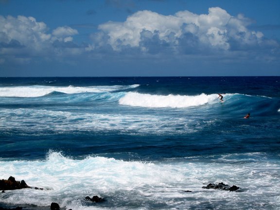
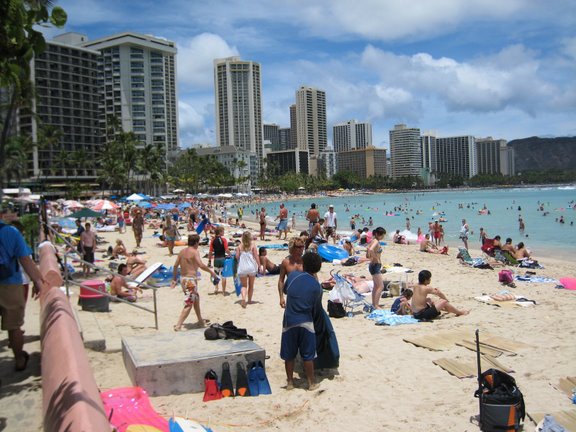
 Kath and I made it to Honolulu yesterday evening, after traveling all day from Memphis. All is well, and we are currently ensconced on the North Shore, waiting for the big waves that will never come, at least not this month. (Because this is summer… Idiot… Idiot…) All of the big waves come in the winter on the North Shore, but that didn’t stop us from enjoying it. In fact, due to the largely empty, placid beaches, we probably enjoyed it more.
No, actually, I knew that the waves would be calm on the North Shore before we booked. I just wanted away from the hectic 4-day package crowd down in Waikiki, and the (relatively) isolated North Shore seems just the ticket. Plus, it would be a great place to escape to after a long day.
However, I’m getting ahead of myself… First, I have to tell you about the generosity and hospitality of Jeff and Katy, who shepherded us from SFO to the ferry terminal for a superb meal.
Well, actually, I need to step back and thank Stephen for taking us to the airport early on the 3rd. The man has a car in the shop, yet he still found the time to get us to the airport on time. A true friend…
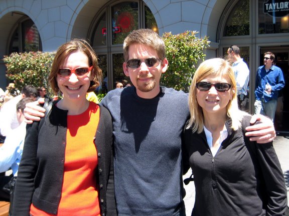 Jeff came and met us at baggage pickup at SFO, but we really didn’t have any baggage, since all our luggage was already checked through to Honolulu. Instead, we could focus on chatting with Jeff, and Katy met up with us down at the ferry terminal so that we could all share an enjoyable meal. Jeff took us back to SFO in time for our next flight, and we continued one of our longest days (at least, by timezone switching), ending up with a rental car at Backpackers Hawaii with a key in an envelope in a drop box. We saw nothing terribly beautiful on the darkness that had already enveloped Oahu.
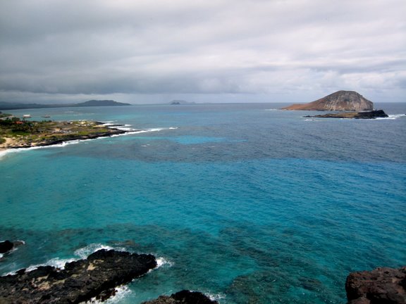
On July 4th, we determined to take advantage our limited time on Oahu and quickly circled the island, ending up near enough to Waikiki. We saw some amazing things, particularly on the “windward coast” (facing the trade winds), in northeast Oahu. There is still something of the spirit of the old Hawaii on these islands, if you know where to find it. The trouble is, though, that the spirit is gradually getting harder and harder to find… (Thanks, Turtle Bay Resort… and Waikiki…)
After several cramped and long hours in Waikiki trying to get a contrast to the rest of the trip, Kath and I made it back to the car (we had to stash it at a mall, as there didn’t seem to be on free parking spot anywhere on Waikiki) to prepare our getaway. Being July 4th, everyone (and, by that, I mean almost everyone) would be near the water.
We rushed back from Waikiki to make an excursions with some of the folks from Backpacker’s Hawaii. Basically, we could not pass on a a July 4th celebration, Hawaii-style. Bar-b-que, fireworks, and good conversation was held at the Schofield Barracks at the center of Hawaii, and after showing ID to the MPs, we were allowed into what is basically a military stronghold complete with pretty stiff protection. And we did not fit in (but that didn’t matter) … 🙂
Thanks to Craig, Brian, Josh, and everyone else at the hostel for inviting us along and allowing us to celebrate the 4th with them. It was a blast!
Kath and I just got back from Larry and Michelle’s wedding on Shelter Island, NY, which was a wonderful affair, enjoyed by all.
We flew into La Guardia on Friday and explored a swath of Harlem with our friends Melissa and Rob, who share a great apartment near 113th Street and Lenox Ave. We ate West African food in the afternoon and poked around the more secluded areas of the northern section of Central Park, before heading into the Upper West Side for some serious window shopping. Later, we ate some Ethiopian food (yes, it was an all-African meal day) before turning in so that we could get up early to catch the train out to the east end of Long Island.
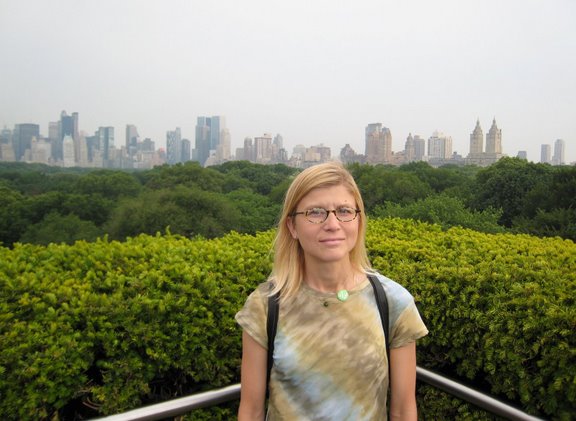 Melissa turned us on to something that is something of an underground NYC thing. Apparently, there are some pretty cool spots to unwind after the long work day is over in the city that most folks, including native New Yorkers, aren’t really aware of. For example, on Fridays after 5 PM, during the summer, you can get to the 4th floor of the Metropolitan Museum of Art via one of the elevators in the back, and a doorman will escort you to a little stairway the leads to the roof of the building, where a bar and 150 or so of your new best friends are waiting. The views are outstanding, with about 200 degrees of visibility, including looking over the park. You feel like you are looking out at building poking up through a lush, green carpet.
Anyway, this post is really about the wedding, which was excellent. This was our first real “East Coast Wedding.” Though I had heard about them before, I didn’t really think that a wedding could go on so long and yet remain so fun and worthwhile. After all, I hail from the South, where we actually get invited to potluck weddings. Yes, where the guests actually bring a dish, along with their wedding gift, which may or may not be something they whittled.
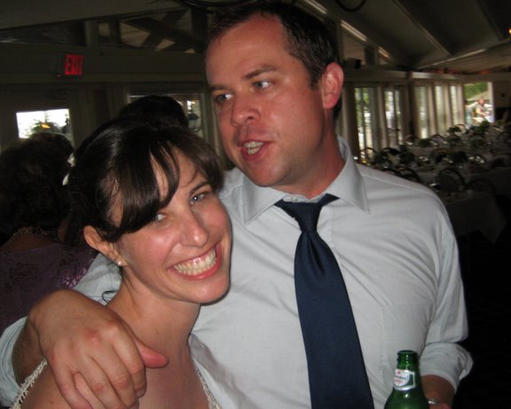 The East Coast Wedding is much more formal affair, complete with a sit-down dinner that goes on for hours and festivities between each of the courses. The 6-hour open bar also helps ratchet up the entertainment. Larry and Michelle were outstanding hosts, going out of their way to make sure we had everything we needed, and the rain held off until after everyone was back to their cabins at the Pridwin, one of the best places to stay on Shelter Island.
Anyway, my thanks goes out to Larry and Michelle for allowing us to share this experience with them. We all really enjoyed it.